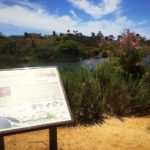
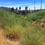
When most people think of where to hike in San Diego, the trails in South San Diego often get neglected. This isn’t because they are any less scenic or beautiful than other San Diego trails, they just simply don’t receive the same level of exposure. The Tijuana River Valley Regional Park has close to 22-miles of well-kept trails to explore. One of those trails is the Tijuana River Valley Regional Park Loop Trail, a good introductory trail to this area that provides scenic views spanning from Mexico to downtown San Diego. At a short 2-miles, this loop can serve as a starting point before exploring other trails within the Tijuana River Valley area.

The Tijuana River Valley Regional Park recently went under a restoration process to clean up and carve out 22.5-miles of trails for hikers, mountain bikers, and equestrians. Native vegetation was being destroyed at the park, which prompted Parks and Recreation officials to work with 20 jurisdictions, agencies and community groups to improve the trail system. Because these trails are close in proximity to the ocean, they also act as a nice reprieve to hot weather often experienced on hikes in east county. The trails are now open for visitors to enjoy the new and improved trail system.


Trailhead
The Tijuana River Valley Regional Park Loop Trail picks up off Monument Road in a dirt parking lot. After parking your car in the lot proceed to the entrance of the lot where you will see a wooden post. This post will guide you in the direction of the short, 2-mile loop trail. Follow the trail as it slowly meanders uphill.

At 0.3 miles you’ll reach your first lookout point. Stop here to take in the breathtaking views of the Tijuana River below and the expansive city of Chula Vista. Take in the miles of farmland that is hard to find in most parts of the heavily industrialized city of San Diego. After stopping for a quick breather, continue following the trail uphill.

As you continue, a wood fence will appear on your right guiding you farther uphill. After a few switchbacks you’ll reach the summit for this trail where you will now see views of Mexico to your left and the city of San Diego to your right. It might be hard to believe that you are just a few miles from the Mexico border, but the boundary fence in the close distance will serve as a welcome reminder. You will likely also come across a few border patrol cars on your hike, like we did, surveying the area.

Head back downhill, following the wide fire road until you reach a marked wood post to your right. Turn right here, following the arrow on the post to complete this short, 2-mile loop and return back to your car.


Turn right here
Tijuana River Valley Regional Park Loop Trail Tips
Tip #1: Despite the recent restoration, the trail signs are often confusing and hard to follow. When in doubt on this trail, follow the paths that lead uphill towards the ocean, and then downhill back towards the parking lot.
Tip #2: This trail is entirely exposed. Wear proper attire and sun protection.
Tip #3: Combine this loop trail with the other trails found right off of Dairy Mart Road to fully appreciate the unique biodiversity in this area.
Tip #4: Watch your step. You will likely be sharing this trail with equestrians.

Driving Directions
From downtown San Diego: Take I-5 South for 12.8 miles. Take exit 2 for Dairy Mart Road. Turn right on Dairy Mart Road and continue on this street for 1.2-miles. Continue onto Monument Road for 0.2 miles. Their will be a large sign that reads Tijuana River Valley Regional Park on your left. Park in the dirt lot near this sign.
Difficulty: Moderate
Total Distance: 2 miles
Trailhead Address: 2721 Monument Rd, San Diego, CA 92154


I’m more familiar with the Trails on the East coast, having recently competed the AT and am working through a nasty case of hiker fever, thinking about hiking the PCT. never would have considered a section hike in San Diego, but this looks beautiful!