Tecolote Canyon Natural Park doesn’t have waterfalls or giant rock formations to lure you in. What it does have is convenience, easy access, and sweeping views of the canyon, golf course and University of San Diego. Tecolote Canyon also offers a solid workout with flat, dirt roads for easy trail running, occasional single-tracks for mountain biking, large ups-and-downs for training, and even a glimpse of wildlife every so often.

Tucked away in a coastal canyon just north-east of Interstate 5 and Interstate 8 is the Tecolote Canyon Natural Park. Despite being in close proximity to commercial and suburban properties, and near a busy interstate, Tecolote Canyon offers peace and recluse in a preserved open space.

There are a number of ways to access various parts of Tecolote Canyon, however I will cover the Main Nature Center Trailhead in this post. To get to the primary trailhead for Tecolote Canyon, park in the parking lot at the Tecolote Canyon Nature Center. Even on weekends there is ample parking so you shouldn’t run into any problems.


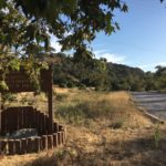
From the Nature Center, follow the marked trail to the left to begin your hike. As you pass through the entryway near the Nature Center, you will immediately encounter a fenced off section containing a native garden and information on the Kumeeyay Indians. To the left, the trail is thick with brush obscuring the views of residences on the other side.


The trail starts on gravel and quickly gives way to dirt. At .1 mile, a side trail, “Battle Trail”, branches off to the right. Follow this trail. Continue onward, until you’ve trekked about .85 miles. There will be an option to turn left(which lead to a dead end). Continue right.


After passing houses and apartment buildings, including the impressive architecture of the University of San Diego, you will begin to veer north.

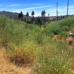
After turning north, you will soon pass a fenced utility station and then the canyon will open up ahead of you. The Tecolote Canyon Golf Course will come into view on your left (1.3 miles into the hike) and two utility roads will become visible ahead. Continue following the lower-powered utility lines down the middle of the canyon. Follow the trail over moderate set of ups and down. At each major rise, a side road veers off to the east to rejoin the other utility line access road until the end.

At the north end of the golf course, the road veers to the east and rejoins the main northbound utility access road. Turn around and retrace your steps at this junction to complete a roundtrip 6-mile hike.

Steeper option

View at the top of the steep ascent option
Alternately at the golf course, you can also take the more eastward fork which follows the higher-powered lines up the east flank and ridgelines. Taking this route requires more endurance with several long uphill jaunts along with several steep descents. This route, however is less scenic and has the loudest crackling noises but is by far the best workout in the canyon. If you want to elevate your heart rate, this is the path to take. Again you will turn around at the north end of the golf course to retrace your steps back to the main trailhead.


Check out this detailed map of Tecolote Canyon hiking trails to start planning your adventure.
Tecolote Canyon Hiking Tips
Tip 1: The Visitor Center has well-kept restrooms to start or end your trip, as well as water fountains.
Tip 2: Check out the educational area adjacent to the Visitor Center for information about native plants and animals as well as the Kumeyaay Indians that inhabited the area long before the Europeans arrived.
Tip 3: There is ample parking at the Visitor Center, however be aware where you park. There are signs warning against foul balls from the baseball field above causing damage to vehicles.
Tip 4: Bikes and leashed dogs are allowed. Keep dogs on a leash as there are many rattlesnake spottings along this trail.
Tip 5: There is not very much coverage along this trail. Bring sunscreen and plenty of water.

Driving Directions: Via I-5S, exit Sea World Drive/Tecolote. Turn left and head east(away from Mission Bay) and park as close to the end of Tecolote Road as you can get.
Difficulty: Easy to moderate (depending on trail taken at the fork)
Total Distance: 6 miles
Trailhead Address: 5180 Tecolote Road, San Diego, CA 92111


