If you’re in need of a quick weekend hike that’s short in length and not too difficult, Switzer Canyon is the ideal hike for you. Located east of Balboa Park, Switzer Canyon is easily accessible with three different trailheads and two trails. The one I’ll discuss here is the most popular trailhead, located at the edge of North Park and takes you to an abandoned graffiti tunnel, arguably Switzer Canyon’s main point of interest.

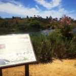
Switzer Canyon itself, although plopped in the middle of suburbia, still boasts an impressive amount of natural vegetation. This is presented almost immediately on the trail, where flowers were overly-abundant amid spring season. The canyon is named after E.D. Switzer who occupied a five-acre farm in the area. Switzer Canyon was also used as an isolation camp during San Diego’s smallpox scare of 1887, due to its remoteness. Today, the canyon is primarily used for hiking and has gone through an extensive restoration process thanks to The Friends of Switzer Canyon organization.

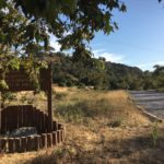
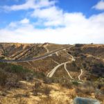
To begin your hike through Switzer Canyon, park your car along the street. The trailhead will be marked by a wooden kiosk. Head downhill, being mindful of your footing. Right away you will be rewarded with expansive views of Balboa Park’s golf course. After a short distance the trail will come to a junction where you can continue straight or veer quickly to the left. Follow the trail to the left, where you’ll reach yet another wooden kiosk.


Follow the trail past the wooden kiosk, and along the narrow dirt trail. The trail will soon transform from dirt to a rocky dry stream bed, which is how the trail will remain for the remainder of your hike. Continue to follow the rocky terrain until you reach an old, graffiti-covered cement drainage tunnel. The tunnel is a good place to stop and explore, however I must do my due diligence and recommend you not to go inside as it could potentially be dangerous to enter.


Near the tunnel, you’ll find a faint trail that will take you to 30 th street. This is easy to miss, so keep your eyes open for a trail that leads uphill to the street. Once you reach 30 th , walk to the northern edge of the canyon to find another steep entry trail. The entry is steep, and not an actual trail but this is the only way to connect between the two sections of Switzer Canyon. If you find the transition too difficult, there is an easier way to extend your hike. Simply retrace your steps back past the second wooden kiosk, back onto the original trail and turn left to continue on the original trail.

You can continue to follow this trail as it flanks the golf course. While you won’t be completely submersed in nature, the urban views and adjacent golf course are still impressive. Be mindful to stay on the dirt path rather than the cement sidewalk as the sidewalk is for golfers only. The dirt trail will eventually end after a little over a mile into your walk and turn to cement, a signal to turn back around. Retrace your steps back to the first trailhead to return to your car.

Switzer Canyon Open Space Park Tips
Tip #1: Wear long pants. There is a decent amount of overgrowth on this trail and it could scrape your legs.
Tip #2: Hike with a friend. While this area of town isn’t dangerous, there is a decent amount of graffiti near the tunnel. It would be safer to hike with another person.
Tip #3: Watch out for golf balls. If you continue your hike on towards the golf course, beware of nearby golfers.
Tip #4: Hiking boots are not necessary, unless continuing onto the section section of Switzer Canyon. The trail is relatively flat for the most part and not too technical. However, you should wear sturdy shoes to traverse over the large rocks scattered about the trail.

Driving Directions
From downtown San Diego, take I-5 S and take exit 15C for Pershing Drive. Continue onto Pershing Drive for 1.3 miles. Take a slight right onto Redwood St. Continue on Redwood St for 0.3 miles. Turn right onto 30 th St. The trailhead will be on your right, marked by a wooden kiosk. Park along the street, being mindful of residents who live in this area.
Trail Difficulty: Easy
Dog Friendly: Yes
Total Distance: 2.8 miles
Trailhead Address: 2800 Maple St, San Diego, CA 92104


