Cuyamaca Rancho State Park has no shortage of peaks to bag including Cuyamaca, Middle, Oakzanita, and Stonewall. Stonewall Peak towers over Julian at 5,730 feet tall and provides stellar 360-degree views of Palomar Mountain, Laguna Mountain, Cuyamaca Peak, and Anza Borrego. This peak offers the best views of San Diego with the least amount of people hiking it. Unlike popular Cowles Mountain, the foot traffic on the Stonewall Peak Trail is minimal—allowing you to fully take in the view from atop without the pressure of having to move to accommodate other eager hikers.

After parking in the lot for the Paso Pichacho campground, the trailhead for Stonewall Peak can be found directly across Highway 79. At the trailhead you’ll see signs warning of mountain lion encounters and the difficulty of this hike. Fear not, this hike is not as difficult as the signs make it out to be. In fact, you’ll tackle the toughest part of the trail right at the beginning and it levels out from there. Here you’ll find two trails, a faint path for the Cold Springs Trail that branches off to the left and the Stonewall Peak Trail to the right. Follow the Stonewall Peak trail.


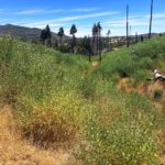
As you follow the switchbacks up to Stonewall Peak, you will emerge out of the trees and poodle dog brush up through recovering chaparral and oak trees. California’s largest recorded fire destroyed much of Cuyamaca Rancho State Park in 2003 and the fires destruction is still very evident on many trails near the area, Stonewall Peak included. As you travel uphill, you’ll see views of Cuyamaca Peak, Middle Peak, North Peak, and Lake Cuyamaca in the distance.


The trail for the next 1.5 miles is very straightforward and easy to follow. The elevation gain is moderate along this stretch, however, it is evenly displaced so the hike never becomes too challenging. At 1.5 miles, you’ll find a trail here that heads north and down to connect to the Caballos Trail and Lake Cuyamaca. Instead, follow the trail to the right and continue towards the peak.


Here you will be greeted by an outcrop of rocks. You can use different side trails to explore these rocks and capture some stunning images of Julian below. Follow the main trail towards the largest granite outcrop at the summit of the peak. A rock staircase will appear with a guard rail for safe climbing. At the top of the rock staircase you will reach the top of Stonewall Peak. There are several informational placards describing the views surrounding you. The top of Stonewall Peak is also surrounded by guardrails to make you feel protected taking in all of your surroundings. Once you’ve had your fill of exploring the rocks nearby and admiring the sweeping views, retrace your steps back to the Paso Picacho parking lot.


History
Stonewall Peak gets its name from the nearby Stonewall Mine, which sits between Stonewall Peak and Lake Cuyamaca. Stonewall Mine was “the richest goal mine ever worked in today’s San Diego County, wrote Leland Fetter in the San Diego History Center’s 2006 Journal of San Diego History. The mine was discovered in 1870 and named after Confederate general Stonewall Jackson. The mine was closed in 1892 after proving to be unproductive. At one point, Stonewall Mine produced more than $1 million in gold and supported close to 200 miners and their families.

Stonewall Peak Trail Tips
Tip #1: You must pay to visit this peak. At the time of this write up, parking in the Paso Picacho campground parking lot is $8.
Tip #2: Rock scramblers rejoice, there are plenty of opportunities to do this here near the peak.
Tip #3: Try to avoid this hike when there is snowfall. Families pack the parking lot to play with the snow and it makes it difficult to find parking anywhere nearby.
Tip #4: Julian is a short 20-minute drive from Stonewall Peak so be sure to treat yo’self to some apple pie after your hike.
Tip #5: If you have a bee allergy BEEware. Wasps are common at the top of the peak.
Tip #6: Poodle Dog Brush, a shrub that causes reactions similar to poison oak, can be found at the beginning of this hike but can be easily avoided if you stay on the trail.

Driving Directions
Take I-8 East to Highway 79. Pass Descanso and turn left at the junction for Highway 80. Turn left into Paso Picacho campground (where you will pay a fee), and park in the day use area.

Elevation Gain: 850 feet
Trail Difficulty: Moderate
Total Distance: 4.4 miles
Trailhead Address: 13652 CA-79, Julian, CA 92036


