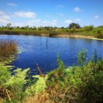
One sunny summer afternoon I got in my car and drove aimlessly, ending up in Fallbrook, about an hour north of San Diego. Looking for recluse from the blazing sun, I found the Santa Margarita Preserve, a shady sanctuary with a well-preserved river running alongside the majority of the trail. The Santa Margarita Preserve is the perfect weekend escape for those looking to switch up their scenery, escape the concrete jungle of San Diego, and hear the gentle lapping of water nearby.
The Santa Margarita Preserve is home to the Santa Margarita River, southern California’s only largely untouched river due to its remote destination and proximity of Camp Pendleton. Because of this, the Santa Margarita River is free of dams, channels, and people have also done a good job of keeping trash out of the river.

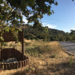
The Santa Margarita Preserve is found off of De Luz Road, a large dirt parking lot with plenty of parking spots, shaded picnic tables, and corrals for horses. The trailhead begins at the edge of the parking lot, marked by a wooden informational kiosk which contains a legend for the trails in the area. Follow the trail next to the wooden kiosk to begin your hike. The trail will immediately take you beneath a plethora of live oaks, shading your path as you trek through the soft sand.

At 0.25-miles, the soft sand will begin to harden a bit and you will begin to hear the hum of car engines as you trek alongside the street. While this may be an annoyance on a busy street, the street the trail runs alongside is relatively deserted and I only heard one or two cars pass by on this portion of the trail. Continue along the sandy trail until you reach your first fork. Here, you can continue forward or take a sharp left. Turn left and follow the path a short distance until you reach the creek. This will be your first creek crossing, with a number of unstable rocks/pieces of wood to help guide you. Fortunately, the water level was low when I hiked here, so even misstep in the water won’t leave you completely soaked.


From the creek crossing, follow the main trail. The trail will take you gradually uphill, leveling out again after just a few hundred yards. Here there will be several spur trails to your left, which will take you down to the trail you originally started on. Continuing forward will take you to a narrow, lightly traversed trail that spits you back towards the parking lot. Avoid this trail as it is difficult to walk through the vegetation that surrounds you and will leave you only completing .75-miles. Instead, retrace your steps back to the creek crossing.

After crossing the creek, follow the main trail until it dead-ends at yet another creek crossing. The creek crossing here is more technical, walking atop slick rocks that form a natural dam over a small waterfall. After crossing the creek continue to follow the trail to the right, where you will need to cross the creek once more. This creek crossing is longer than the previous two and it is easier here to lose your balance and fall in. The water only went up to my ankles when I fell in, however I’d recommend taking a second pair of shoes on this hike.


From here, continue following the trail. The trail will continue onward until you reach a main road, which is a good turn around point or you can continue forward on the Santa Margarita River Trail, depending on your preference. Turning around here will leave you with a good 5-miles accomplished.

Santa Margarita Preserve Tips
Tip #1: Bring a spare pair of shoes or waterproof shoes. There are a number of creek crossings here with unstable rocks, making it easy to accidentally fall into the shallow water.
Tip #2: Plug in the address below into your GPS. Simply typing Santa Margarita Preserve will take you to the wrong address that dead ends.
Tip #3: Keep an eye out for horse manure as this trail is open to both hikers and equestrians.
Tip #4: This hike is not for children or people with mobility issues as there are portions of the trail which require walking through soft sand and across unstable rocks at creek crossings.
Tip #5: There are no bathrooms at this trail. Use the restroom facilities at nearby stores/restaurants before starting your hike.

Driving Directions
From downtown San Diego: Take CA-163N and merge onto I-15N. Continue on I-15N for 32.5 miles. Take exit 51 towards Mission Road/Fallbrook. Turn left onto Old Hwy 395. Turn right onto E Mission Road and follow this road for 4.9 miles. Turn right onto N Pico Ave. Continue onto De Luz Road. The trailhead will be on the right side of the road in a large dirt lot.
Park Hours: Open daily from 8:00 am-sunset
Park Phone: 760-728-2303
Difficulty: Easy
Total Distance: 4 miles
Trailhead Address: 37385 De Luz Rd, Fallbrook, CA 92028


