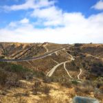
The Penny Pines trail is located just a quick hour-drive from downtown San Diego up in the beautiful Laguna Mountains and offers stunning viewpoints. This hike features 6,000 feet of elevation gain to Garnet Peak and a long stretch along the infamous Pacific Crest Trail(PCT) to Pioneer Mail. For hiking enthusiasts, although it is tucked far away in Cleveland National Forest , this is a must-visit day-trip that will provide you with stunning views and if you visit in the fall, plenty of foliage that often isn’t seen in the city of San Diego. To make the trip worth it, in addition to tackling Garnet Peak, I also tacked on a portion of the PCT to the Pioneer Mail trailhead, and then re-traced my steps to make this a 10.4-mile roundtrip hike.

If you choose to shorten the distance, you can also hike from Pioneer Mail to Garnet Peak, a 6-mile hike, or just simply hike to Garnet Peak from the Penny Pines trailhead for a 4.4-mile hike.

Trailhead
To complete all 10.4-miles and walk a longer stretch of the PCT, begin by parking your car in the Penny Pines parking area off Sunrise Highway. Avoid the signed Garnet Peak Trail to the left, this trail is about half the distance (unless, of course, you want to hike a shorter distance). Instead, take the trail directly to the right of the Garnet Peak Trailhead, marked for the PCT. Follow the trail north on a rocky, winding path that will take you past several unique rock formations and the ever-expansive Anza-Borrego Desert. Soon you’ll reach the burned zone of the Jeffrey Pine Forest and cross the Pacific Crest Trail.


At 2.5-miles you will reach the intersection for the Garnet Peak Trail. Turn right to follow the Garnet Peak Trail, which is clearly marked, and ascend to the peak. Climb up the rocky trail for about .5-miles. The trail is steep uphill and the gravel is loose, so exercise caution while ascending uphill. After a few hundred yards, the trail will bend right and you will need to climb over rocks to reach the summit.


The 360-degree view of the summit is incredible and on a clear day, you can see Mount Baldy, San Jacinto, San Gorgonio, the Salton Sea to the east, and the Anza-Borrego Desert. To the south and west lies the Laguna Mountain crest, pitted with oak and pine forests, some scalded by a forest fire. On the day we summited Garnet Peak, the wind was especially prevalent—strong enough to nearly knock my cell phone out of my hands and blow my sunglasses off my head.


Descend back down the same trail to return back to the intersection. At the intersection, turn right to follow the PCT to Pioneer Mail. The trail continues through burned areas, although their were some wildflowers in bloom and leaves were changing colors—painting a picturesque scene. The trail remains relatively flat for the next mile. Soon you will be walking alongside Sunrise Highway. Hearing the cars pass by slightly interrupted the solitude—very few people were traveling along this trail when we went even though it was a Sunday—however, the stint along the highway is brief.


At around 4 miles, the trail will begin to switchback down a small hill. Signs of the 2013 fire are evident in the form of the charred skeletons of chaparral along the hillside, but most of the oak trees seemed to have survived. Tall grasses also tried to hide the damage, growing over the blackened remains. The end of your journey will be marked by a gapped fence along the southeast side of the Pioneer Mail parking lot. Here you’ll find a picnic area and a bathroom. Re-trace your steps back along the PCT to get back to the Penny Pines Parking area.

Although the Chariot Fire ran through Mount Laguna and charred much of this trail, there is still evidence that with time this portion of the PCT will make a full recovery. Aside from this trail, even driving through the small Mount Laguna community is rewarding enough and makes you feel as though you are in a different state rather than San Diego, California. I completed this hike in November, and would highly recommend other fall-foliage seekers to visit this time of year to get a small taste of true Autumn.

Penny Pines/Garnet Peak/Pioneer Mail Tips
Tip #1: Pick up your $5 adventure pass at the Laguna Mountain Lodge(on the left as you go through the mountain “village” of Mount Laguna.
Tip #2: Wear hiking boots to protect your feet and ankles up the rocky ascent to Garnet Peak.
Tip #3: Prepare in advance for weather conditions. The weather in San Diego or Los Angeles is likely to be much different than up in Laguna Mountain. When we went, the difference in temperature from San Diego to Laguna Mountain was 20 degrees colder.
Tip #4: Stop by the visitor center to pick up a comprehensive hiking map.
Tip #5: Set aside approximately 4 hours total for the entire hike (10.4-miles).
Tip #6: Cheer on PCT thru-hikers. You may encounter some attempting to tackle this prestigious feat along the way.
Tip #7: After completing your hike, stop by in Alpine at the Alpine Beer Company for some amazing BBQ and Mac and Cheese that is to die for.

Trail Difficulty: Moderate
Total Distance: 10.4 miles
Trailhead Address: 12000 Sunrise Hwy, Pine Valley, CA 91962
Driving Directions: From the I-5, I-15, and state route 67, travel east on I-8 and exit on the Sunrise Highway off-ramp. Turn left, and follow sunrise highway up through the forest, past the village at Mt. Laguna, and park at the Penny Pines Trailhead.


