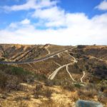
I almost hesitated to write this post because the greater majority of my posts rant and rave about local trails. However, I also want to give people my honest opinion, even if that opinion may deter people from checking out a trail. Chula Vista is hardly my go-to option when scoping out hikes in San Diego, however I’ve been making an earnest effort to check out all the trails in the county. This prompted me to check out the Otay River Valley Trail, an 8.3-mile out and back hike which runs through the heart of Chula Vista.

The trail is flat, relatively easy to navigate, and quiet making it an ideal weekend escape from reality. The major downfall of this trail is the transients which we found lurking in the bushes, under the overpasses, and even camped out along the trail which made our experience a little unpleasant. My advice from the start is if you do choose to check this trail out is to exercise caution and hike with a large group of people in order to stay safe.

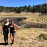
There are several different staging areas at Otay Valley Regional Park. We chose to park at the Beyer Boulevard Staging Area, a small dirt lot that is easy to miss if you blink. After parking in the dirt lot proceed to the the wooden kiosk for the Otay River Valley Trail. The trail almost immediately presents you with gorgeous views of the Le May pond. Here you may see people fishing on the edges of the pond.


Follow the trail until you reach a “T” fork in the road. Follow the trail to the right. You’ll soon walk passed a wire fence. If you follow the main trail forward, this will lead you to even better views of the pond but dead ends at a bench. Take in the views of the pond and re-trace your steps back towards the wire fence.


To your right, you’ll spot a narrow dirt trail to your right. Follow this trail to continue on the Otay River Valley Trail. At 0.4-miles you will reach another staging area. This lot was significantly less crowded than the Beyer Boulevard Staging Area and appeared as though it was better suited for those with horses/trailers. Follow the trail past the staging area.

At 0.8-miles you’ll pass beneath the overpass. This was our first encounter with a transient, and not the most pleasant encounter at that. There was an abundance of graffiti under the overpass which was interesting to look at, but also a welcome reminder that suspicious activity does take place around here. After our less than favorable encounter with the transient, we pushed forward and continued to follow the Otay River Trail.


At a “Y” junction, follow the trail that veers to the left to stay on the Otay River Valley Trail. The trail at this portion turns from dirt to loose rocks and gets a little bit more technical. Continue along the trail until you reach yet another overpass, albeit this one will be shorter. We followed the trail for about another half mile at this point and decided to turn around when we saw a few mountain bikers. They helped escort us back past the transients we saw and helped us reach the trailhead safely.

You can continue along the Otay River Valley Trail for a total of 8.3 miles but keep in mind this trail does not loop and is an out and back trail.
Otay River Valley Trail Tips
Tip #1: Always hike here with a friend and not solo. This area does have transients and while most are harmless, it is better to be safe than sorry.
Tip #2: There is almost no sun coverage on this hike. Wear proper attire and plenty of sunscreen and bring plenty of water.
Tip #3: Be mindful that this trail does not loop around. It is out and back only so take this into consideration when determining how far out you’d like to hike.
Tip #4: Fishing is very popular in the pond here. Bring a fishing rod to fit right in with the crowd.
Tip #5: Restroom facilities are available at the trailhead.
Tip #6: Horse facilities are available at the sating area on Mace Street. Equestrians can not go west of Beyer Way or east of I-805.

Driving Directions
From downtown San Diego: Take I-5S to CA-905E. Continue onto CA-905E for 0.8 miles. Take exit 1 for Beyer Blvd and turn right. In 0.5-miles, turn right onto Del Sol Blvd. Turn right onto Beyer Way. Park in the dirt parking lot with marked with a large sign that reads: Otay River Valley Regional Park Beyer Boulevard Staging Area.
Elevation Gain: 274 feet
Difficulty: Easy
Total Distance: 8.3 miles
Trailhead Address: 2155 Beyer Way, San Diego, CA 92154
Resources: Otay River Valley Regional Park Trail Map

