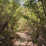
Mission Trails Regional Park is my go-to hiking destination when I want to get a hike in but I’m in a pinch for time. Conveniently located about 20 minutes from downtown San Diego, this destination is home to several of the county’s most prominent peaks. North Fortuna Peak is the third tallest peak at Mission Trails, towering high above the park at 1,291 feet. There are a multitude of ways to reach North Fortuna Summit, however the trail we will cover here can be accessed via the Oak Canyon Trail in the Old Mission Dam parking area.

After parking in the Old Mission Dam parking area or nearby on the shoulder of Father Junipero Serra Trail, walk through the parking lot towards the wooden kiosk on your left. It may be helpful to pick up a free trail map here as there are a few points where the trail can get confusing. Continue to head past an area of picnic tables and the Old Mission Dam on your right to cross a long wooden foot bridge. This is where the Oak Canyon Trail will commence.


The trail will follow a dirt path at the onset, then quickly transform to a rocky terrain as you make your way up the canyon. During months of rain, the footbridges placed conveniently along the path will help protect you from the rarely wet rock bed. However, given this is San Diego, water along this portion of the trail is a rare occurrence and it is unlikely you’ll see more than a small trickle in warmer months.


At the first junction you reach, you’ll have the option to veer left or right. Stay left to continue on the Oak Canyon Trail. At this point the trail will become even rockier and more technical. Fear not as this short stretch of rocky terrain will only last a little bit longer before leveling out to a dirt path once more.

After a little over a mile of hiking, you’ll reach your second junction. Stay to the right to continue on the Oak Canyon Trail. Shortly ahead you’ll see the Highway 52 bridge running across the canyon overhead. Walk all the way up to the bridge where you’ll find a “T” junction. Stay to your left to begin the toughest portion of this trail.


Here, the trail becomes more straightforward, taking you up three steep inclines. Exercise caution when hiking up these hills as the gravel is rocky and unstable at points. A pair of trekking poles would be helpful with the climbs. I had a good pair of hiking boots on with decent grip and was able to make it up without any slips. Eventually, when you regain your breath from the intense cardio climb you just endured, you’ll notice the trail will come to almost an abrupt end near Highway 52.

Turn left here, just before the metal fence which acts as a barrier to the highway, and follow the small brown sign for the North Fortuna Trail. You’ll need to climb uphill, albeit this time will be far less strenuous with wooden steps and sturdy dirt to make for a more enjoyable climb.

At 2.7 miles, you’ll come to another “Y” junction where you’ll turn left to follow the sign for the North Fortuna Summit. From here, you have another 0.4 mile climb to reach the North Fortuna Peak, which at this point should seem like child’s play compared to the others hills you’ve conquered. Enjoy the cool breeze and views from the summit, which provide an all-encompassing view of Mission Trails Regional Park.


After taking in the views, continue along the ridge south past a false summit and downhill. Once the trail evens out, you’ll come across a 4-way junction. Follow the trail left towards the East Fortuna Service Road. This road is nearly equally as rocky and unnerving as the hills you climbed getting up to North Fortuna Peak, again another instance where trekking poles would be welcome. When your steep descent comes to an end, the trail will reconnect with the Oak Canyon Trail where you’ll continue forward until you reach the trailhead and conclude one of Mission Trail’s most cardio-intensive loop trails.
North Fortuna Peak Trail Tips
- Arrive early. Parking at Mission Trails Regional Park fills up quickly.
- Wear hiking boots. There are many technical portions of this trail where hikers can benefit from wearing shoes with good grip.
- Bring trekking poles. These will be helpful on the multiple steep uphill/downhill portions of the trail.
- Follow the signage. It’s easy to get lost at Mission Trails due to the sheer number of trails here. Pay attention to each sign you encounter.
- Bring plenty of water. The majority of this hike has no shade coverage. Additionally, it may be more enjoyable to hike here in cooler months.
Driving Directions
From downtown San Diego, take CA-163 N and use the right two lanes to merge onto I-8E toward El Centro. In 3.1 miles, use the right two lanes to take exit 8 to merge onto I-15 N. Take exit 7A for Friars Road E. Merge onto Friars Rd. Continue onto Mission Gorge Road. In 3.2 miles, turn left onto Father Junipero Serra Trail. Continue down the one-lane road for approximately 2 miles until you reach the Old Mission Dam parking area. If this lot is full, there is another dirt lot nearby for the Kwaay Paay trailhead where you may park as well.
Elevation Gain: 1,300 feet
Difficulty: Moderate to strenuous
Total Distance: 5.8 miles
Dog-friendly: Yes
Trailhead Address: Old Mission Dam, 1 Father Junipero Serra Trail, San Diego, CA 92119


