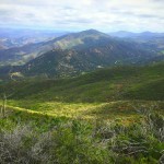
If you are a resident of San Diego you’ve likely heard of Mount Woodson. This San Diego staple hike is frequented by many eager to capture a picture atop the infamous “Potato Chip Rock”, a thin slab of granite that appears ready to break at any given moment. Yet hikers take their chances and wait in a 30-minute line to capture a picture with this well-known gem. Many are aware of the typical route hikers take to get to Potato Chip Rock: parking in the Lake Poway lot. This grueling uphill battle requires close to 7 miles of intense elevation gain. However, there is yet another way to get to the top along the Mount Woodson backside trail.

The FDR CCC Mount Woodson Backside Trail will take you up to the peak of Mount Woodson in a much shorter stretch. This 4-mile route begins in Ramona near the Iron Mountain trailhead and provides an equally grueling workout, however with less ground to cover. After parking alongside Highway 67, near the entrance to the California Division of Forestry fire station, you’ll find two signs: one green that reads “Hiking Trail” and another white sign that says “Potato Chip Rock”. Follow the arrows on the signs to begin your hike. You’ll first travel along a dirt trail before meeting up with a paved service road known as the FDR CCC trail.


The paved trail begins its unforgiving uphill ascent almost immediately. The trail may be steep, however the stellar views will have you forgetting just how difficult this trek can be. First you’ll pass a water tank, as the trail begins to wind with subtle switch backs. The road from here is extremely straightforward and easy to follow.


At 1.7 miles, you’ll reach the top of Mount Woodson. A large expanse of radio antennas will appear amid the outcrops of boulders letting you know you are almost to your desired destination. Here you’ll have views of the city of Poway, north San Diego, and even Santa Catalina and the San Clemente Islands on a clear day. You’ll know you’ve finally arrived at Potato Chip Rock when you see a line of people appear. These eager individuals are waiting to capture a picture on top of the rock. You can join these enthusiasts in waiting (wait times can extend up to thirty minutes or more on weekends) or admire them from afar. When you’ve had your fair share of admiring the views and conversing with other hikers, retrace your steps back downhill towards the fire station.


Mount Woodson Backside Trail Tips
Tip #1: Visit this trail at sunset to see truly stunning views of the city from high above.
Tip #2: Leashed dogs are allowed on this trail so feel free to bring your furry best friends.
Tip #3: There is no parking lot for this hike, instead you must park on the side of the road. Do not leave your valuables exposed.
Tip #4: Many hikers choose to hike this when there is a full moon. Bring a headlamp or flashlight to help guide the way.
Tip #5: Much of this trail is paved with good traction. Hiking boots are not entirely necessary.
Tip #6: Despite this being one of the most popular mountains in San Diego, this hike is not suitable for beginner hikers due to the quick elevation gain in a short distance.
Tip #7: Bring plenty of water. The FDR CCC Trail is fully exposed to the sun with minimal shade along the entirety of the route.

Driving Directions
To reach the Mount Woodson backside trail, follow I-15 North and exit Scripps Poway Parkway. Turn right and follow the road east until it meets the 67. You will pass the trail head to Iron Mountain on your right and the end of Poway Road on your left, keep going past this point for another 3 miles north of Poway Road, near the entrance to the California Division of Forestry fire station. Do NOT park on Fire Station property.


Difficulty: Moderate
Elevation Gain: 1,500 feet
Total Distance: 4 miles
Trailhead address: 16200 Hwy 67, Ramona, CA


