The Laguna Mountains provides some of the most prime hiking destinations in all of southern California, offering hikers arguably the best views of San Diego county and beyond. One trail that doesn’t fail to deliver on spectacular views is the Monument Peak Trail, a nearly 6-mile out-and-back hike that covers a portion of the Pacific Crest Trail (PCT).

This moderate-intensity out-and-back trail allows hikers to walk along a portion of the iconic PCT and features all-encompassing views of the surrounding mountains, Anza Borrego desert, and far beyond on the clearest days. There are two ways to hike to Monument Peak, however the one I’ll cover here features a nearly 6-mile stretch along the PCT to the peak.


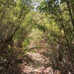
The trail to Monument Peak begins in the Desert View Picnic area. The faint trail can be difficult to locate, but begins near the restroom facilities, walking downhill past the picnic tables where a narrow, slightly overgrown trail will come into view. Follow this trail until it splits in a “T”. At the junction, veer to the left to follow the Pacific Crest Trail. You’ll soon pass beneath the green leaves of multiple California black oaks looming overhead.


After a short distance, you’ll reach a paved road with signage pointing toward the postage office, general store, restaurants, and more to your left. For hikers just beginning their long trek along the PCT, this is a popular place to stop and gear up for their months-long journey ahead. Cross the paved road to rejoin the dirt Pacific Crest Trail. You’ll immediately be covered once more by the canopy of staggering pine and oak trees looming high above.


Continue on the Pacific Crest Trail for a short distance further until you reach yet another paved road, where you will cross and rejoin the dirt trail once more. The trail here is straightforward for the next mile until you reach a junction for the Big Laguna Trail, branching off to your left. Avoid this junction and continue straight along the PCT.

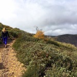
You’ll soon emerge out of the shade coverage of trees and into a chaparral-covered landscape. This is where most of your elevation will be gained, albeit along a steady and never-too-strenuous route. On your ascent, you’ll encounter a junction for the PCT and there will be a narrow trail leading uphill. This trail is between 2 PCT signs. Follow this narrow trail to conclude your hike up to Monument Peak.


The ascent will level-out once it comes to the saddle between Monument Peak and Hayes Peak. Here you’ll see a few trailers behind a chain-linked fence. Walk around the trailers to reach a paved access road that will take you up to Monument Peak. Turn left at the paved road and walk uphill toward the staggering antennae looming overhead. As you make your way up, you’ll see sweeping views of the dense forest that blankets Mount Laguna to the west and the expansive Anza Borrego desert to the east. On the clearest of days, you can see all the way to Arizona, 200 miles in the distance.


The stark contrast between barren desert landscape and lush green forest, make this one of the more unique views in all of San Diego county. Sit on the paved cement beneath the antenna to take a snack break while enjoying the surrounding views. When you’ve had your fix, follow the same route back, retracing your steps down the paved road, back to the PCT.


Monument Peak Trail Tips
Tip #1: Shorter route available. This is the longer, more rigorous route. An easier, 2.6-mile route is available via the Big Laguna Trail Access on the east side of Sunrise Highway.
Tip #2: Wear hiking boots. The ascent up Monument Peak is rocky and somewhat technical. Shoes with good grip will be helpful.
Tip #3: Display your Adventure Pass. A $5 Adventure Pass is required for this trail. Passes can be purchased at REI, Forest district offices, or the main Cleveland National Forest office.
Tip #4: Watch for the Community Church signage when parking. At the time of this post, the sign for Desert View Picnic Area had been knocked down by strong winds, making the lot, located directly after the Community Church, easy to miss.
Tip #5: If restrooms are out of service, visit the Visitors Center approximately a 2-minute drive away. At the time of this post, the restroom facilities at the Desert View Picnic Area were out of order.

Driving Directions
From downtown San Diego, Take CA-163 N for 3.1 miles and use the right 2 lanes to take exit 3A to merge onto I-8 E toward El Centro. Follow I-8 E for 41.1 miles. Take exit 47 toward Sunrise Hwy. Turn left onto County Rte S1/Old Hwy 80 for 10.1 miles. Turn right onto Desert View Road, the road directly after the sign for Mount Laguna Community Church. Park anywhere in the parking lot and display your Adventure Pass.
Elevation Gain: 1,000 feet
Difficulty: Moderate
Total Distance: 5.5 miles
Trailhead Address: Desert View Rd, Mt Laguna, CA 91948
Dog Friendly: Yes


