There aren’t many trails in San Diego that give a free glimpse into California’s mining history. The McGinty Mountain Trail does just this, while also offering a challenging hike with breathtaking views. McGinty Mountain is located in Jamul, a quick 25-minute drive from downtown San Diego, and is home to a few different “rare and endangered plant species,” Jerry Schad wrote . While there is not as much foot traffic on this trail as nearby Mount Woodson, Iron Mountain, and Cowles Mountain, the views at the summit are equally as stunning and worth taking in.

The trailhead for McGinty Mountain starts at the edge of a dirt parking lot, marked by a kiosk with a posted trail map. The map provides you with the general route to take to reach the summit. Follow the trail up the side of the mountain as the trail meanders through a series of long switchbacks. The elevation gain is most significant here and near the end, so this portion of the trail may seem challenging. At the end of the initial climb, you’ll have the choice to turn left or right. To the right you’ll find a small cave after walking a few hundred feet. Enter this cave at your own risk. When I explored, it was filled with beetles so needless to say I didn’t get very far into the cave.


Small Cave

Overlook near the cave
From here backtrack to the intersection and continue past where you ascended. The grade will taper here and won’t be as intense as your initial climb. Trail signs will be posted intermittently to help keep you on the right track.

At 1.5 miles you will reach a fork in the trail with one trail heading uphill along a fainter path. Avoid this trail and keep to the right, sticking to the heavily traveled dirt path. This stretch of the trail is not only easy to navigate but also traverse, giving your glutes a welcome break.

At 2.2 miles, you will encounter one more steep climb uphill to get to the peak of McGinty Mountain. Here is where you will see one of the old mines off in the distance. It is easy to miss but the picture below shows where to stop to see it.

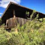
Mine in the distance

At 2.6 miles you will reach the summit for McGinty Mountain. This requires a short climb uphill and a bit of rock scrambling. Once you reach the summit, you will be rewarded with views of Mount Helix and Cowles Mountain to your west and San Miguel Mountain and Tecate Peak to the east. Once you’ve had your fix, re-trace your steps downhill to the parking lot.


It is possible to continue forward even after the peak, however we did not explore much further out since it led downhill and we really couldn’t stomach another uphill jaunt.

McGinty Mountain Trail Tips
Tip #1: There are a good number of spur trails along the way. As a general rule of thumb, pick the routes that are wider and look more-travelled.
Tip #2: There are portions of the trail which are both steep and slippery, especially after rainfall. Wear hiking boots/shoes with good traction.
Tip #3: There are no restroom facilities on or near the trail so make sure to stop in town beforehand.
Tip #4: This is not a beginner’s hike. There are many challenging areas of the trail with steep ascents. With that being said, for a seasoned hiker, this trail will likely be moderate difficulty.
Tip #5: Leashed dogs are allowed on this trail. Be certain to leave your dog on a leash as many people hike with their dogs here.

Driving Directions
Take 94 East, exiting at Campo Road. Follow Campo Raod for approximately 4.5 miles, turning left onto Lyons Valley Road. Follow Lyons Valley Road 0.7 mile north from Highway 94. Turn left on Jamul Drive, and follow the road 0.4 mile to the dirt turnout. Park in the small dirt parking lot and proceed towards the kiosk.
Trail Difficulty: Moderate to strenuous
Total Distance: 5.3 miles
Elevation Gain: 1,300’
Trailhead Address: 13852-, 13998 Jamul Drive, Jamul, CA 91935


