It may be a bit of a drive to get to and essentially in the middle of nowhere, but Lawson Peak is worth the epic climb. Located in the southern end of Cleveland National Forest, Lawson Peak towers high above the ground next to the equally as impressive Gaskill Peak. The moderately steep ascent up to Lawson Peak is followed by a quarter-mile rock climbing adventure, making this peak one you have to work for to summit.

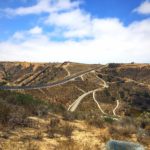
The trailhead for Lawson Peak is almost directly across from Mile Marker 13 on Lyons Valley Road. Pass through the large steel gate and begin your ascent uphill. The trail is extremely straightforward for the first two miles as you follow a wide dirt stretch of road.

Trailhead

Please note this trail is rugged, there is plenty of loose gravel and the majority is uneven. A pair of good hiking boots with decent traction is ideal for this portion of the hike. The ascent will moderately strenuous, but the views of the endless mountain ranges in the distance provide a nice distraction. On clear days, you’ll be able to view Mt. San Jacinto and Mt. Bald in the distance.
At two miles, you will reach the main trail junction. You could continue to the left to check out a much smaller rock formation known as Pancake Rock. To reach Lawson Peak, continue straight forward.


Trail junction
You’ll continue a short distance until you reach a heaping pile of rocks, slowly working their way up to the peak. Here is where the real fun begins. This is where you’ll need to test both your endurance and arm strength, pulling yourself up a quarter-mile stretch of boulders. The path becomes unclear at times here, but when in doubt try to follow the rocks with well-exposed grips and footholds and continue climbing up towards the biggest rock at the top.


Just when you feel out of breath and gasping for air, you’ll have one last hurdle to climb to reach the true summit. Only a vertical rock cave stands in your way of getting to the prize. At the time of this post, other hikers had secured a rope to help you climb up the cave to Lawson Peak. Once you get to the top, the 360 degree views are impressive, offering you unobstructed views of the back country. If you’re feeling up to it, Gaskill Peak looms nearby and can also be bagged in the same hike by adding on a few extra miles. Combining Gaskill Peak with Lawson Peak will be 8.1 miles total.

If at any point during the rock climbing portion of this hike you feel uncomfortable listen to your gut. It is more important to feel safe and secure than to push your limits and potentially get injured. There will also be an easier peak on your right you can climb that offers equally as impressive views. Above all else, stay safe and listen to your body.

Lawson Peak Tips
Tip #1: Wear proper shoes. The majority of this hike requires technical footing and climbing.
Tip #2: Be wary of snakes. Snakes typically make their homes under rocks and you will be climbing plenty of them.
Tip #3: Leave your pets at home. Unless you plan to carry your dog on your back, it will be nearly impossible for them to climb up to the peak with you.
Tip #4: Bring a friend. This trail experiences little foot traffic. With the amount of rock climbing you’ll be doing, it is better to have a friend with you in case an accident were to happen.
Tip #5: Know your limits. This peak is difficult to bag even for experienced hikers. You’ll need to climb many rocks to reach the summit. If this sounds daunting at all, it is best to skip the summit and stop the hike at the 2-mile mark.

Driving Directions
Take I-8 East for miles, exiting at Route 79. Turn right onto Japatul Valley Road. Drive six miles and turn left onto Lyons Valley Road. Follow Lyons Valley Road approximately 4.5 miles and park in the dirt turnout right before Mile Marker 13. If you reach signs for Route 94, you’ve gone too far and will need to turn around.
Elevation Gain: 1,600 feet
Difficulty: Strenuous
Total Distance: 4.6 miles
Trailhead Address: Lawson Peak, San Diego, CA 91935
Lawson Peak Trail Map: View here


