Aside from the countless staggering peaks found at Cuyamaca Rancho State Park, Lake Cuyamaca also serves as one of the many additional points of interest. The 100-acre deep blue lake offers fishers a prime spot for catching trout and other species of fish including Florida bass, smallmouth bass, channel catfish, crappie, bluegill and sturgeon. Luckily for us hikers, the perimeter of Lake Cuyamaca can be hiked in its entirety, by taking a number of different trails to complete a 5-mile loop. The Cuyamaca Loop Trail therefore is not one single trail, but two different trails that merge to allow hikers to experience the entire lake in all its glory.

The Lake Cuyamaca Loop Trail commences at the Trout Pond Parking area, the same lot you’d park at for the popular Middle Peak Trail . This trailhead sits at the very edge of the 26,000-acre Cuyamaca Rancho State Park, in the very near vicinity to the town of Julian. While there is no actual “Trout Pond” trail, the name of the parking area is an ode to the numerous trout stocked annually for San Diegan fishers to enjoy.

After parking your car in the small Trout Pond dirt parking area, look for the single-track trail that leads past the wooden kiosk at the edge of the parking area.

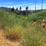
Follow this narrow trail, also known as the Marty Minshall/Los Vaqueros Trail, as it takes you through a large meadow, one that sometimes becomes too flooded to trek through after heavy rain. After hiking along this well-defined trail for nearly half a mile, the trail will intersect with the Los Caballos Trail. Keep following the Marty Minshall trail as you begin to emerge beneath the shade coverage of some of the trees that were not destroyed by the devastating 2003 Cedar Fire.

At 1-mile into your hike, you’ll find a trail to your right that will take you to Stonewall Mine. Do not follow this trail, as it will take you away from the lake and to, as the name suggests, the once-prosperous Stonewall Mine. The Stonewall Mine hike is a great trail to experience on a separate occasion, to get a glimpse into San Diego’s once-bustling mining history.

Stay on the Minshall Trail until you see a large wooden bridge on your left. This will be your cue to leave the Minshall Trail behind. To reach the bridge, walk through a narrow opening on the left side of the fence. Cross the bridge, where you will likely see fishers trying their luck.

After the bridge, veer turn left to continue onto the Lake Trail, the trail that will take you around the remaining perimeter of the lake. The trail will take hikers along the northern shore and past Chambers Park, where you will find more fishers along the docks.

Here, you will also find restroom facilities and a drinking fountain should you need to refill your water supply. Continue through the park until you reach the Lake Trail once again, walking along the dirt path for a short distance further until you reach Lone Pine Camp. Several lake-front campsites will be on your left, while you walk forward through the paved parking lot before rejoining the dirt path once more.

The Lake Trail will take you up to the Lake Cuyamaca Dam, before you meet with the SR-79. Walk on the small dirt path along the side of the freeway, exercising caution where you walk as cars pass you by. When you reach the Lake Cuyamaca Restaurant and Store, follow the paved road downhill and away from SR-79, walking through the parking lot, the last paved portion of the trail. Rejoin the Lake Trail for the last time as it meanders through an open meadow and across several short wooden footbridges.

Eventually, the trail will meet up with the Minshall Trail, marked by a wooden marker, where you will continue for another half-mile before returning to the Trout Pond parking area to close the loop.

Lake Cuyamaca Loop Trail Tips
- Wear long pants. There are many overgrown parts of the trail that will scratch your legs.
- Hiking boots not required. There is minimal elevation gained on this hike and no technical parts of the trail.
- Bring the family. Because of the flatness of this trail, this hike would be a good option for families with children that are capable of walking 5 miles.
- Do not hike this trail after rain. The initial portion of the trail will be too flooded to hike comfortably through. I made this mistake once and had to find an alternate hike nearby.
- Stop by Julian for pie after your hike. Julian is home to arguably the best pie San Diego has to offer. My favorite pie shop is Mom’s pies, albeit the wait to get pie is usually pretty long.

Driving Directions
From downtown San Diego take I-8 E for 22.2 miles. Take exit 40 for CA-79 N/Japatul Valley Road toward Julian. Turn left to stay on CA-79 N towards Julian/Cuyamaca Rancho State Park. Drive approximately 10.5 miles past the Green Valley Falls Campground, just before the Sweetwater Bridge. Park in the large dirt parking lot on the right side of the road marked by a sign that reads “Trout Pond” across from Milk Ranch Road, just before SR-79N turns a sharp right. Parking is free.

Elevation Gain: 200 feet
Difficulty: Easy
Total Distance: 5 miles
Dog-friendly: No
Trailhead Address: Old Mission Dam, 1 Father Junipero Serra Trail, San Diego, CA 92119


