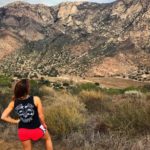
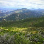
There are few places in California where you can hike a volcano. Lake Calavera Preserve is one of them. Located in Oceanside/Carlsbad area, Mt. Calavera was once an active volcano millions of years ago. Today, the volcano is dormant, but a series of trails have been formed to allow hikers to explore the many wonders of the preserve. The short, 3.1-mile loop I took while visiting Lake Calavera covers the greater majority of the highlights you’ll found here.

I began my hike at the marked trailhead off Lake Drive. Upon parking, you’ll see Mt. Calavera looming in the distance and Lake Calavera itself, along with a series of trail systems that lead around the lake and up to the top of the volcano. To start the main loop, walk along the trail that starts with a wooden kiosk that gives an overview of the Lake Calavera Preserve along with a map of the trails in the area.


At the first junction, make a left walking past a large metal gate. Follow the marked signs for “Creek Crossing”. Here, it becomes evident that the city of Carlsbad has done some restoration to protect and enhance the preserve with large trail signs, a new wooden boardwalk, and fenced off portions of the trail designed to help preserve the land. Cross the wooden boardwalk to regroup with the trail that will lead you to the top of Mt. Calavera. Continue following the marked “Peak” sign, steadily making your way uphill towards the mountain that looms ahead.


You’ll reach another trail junction approximately one mile into your hike, with one trail that continues forward and another to the right that will lead you up the side of the mountain. Follow the trail to the right, steadily climbing the side of the mountain until you get to the peak. This is where you will gain most of the elevation in a relatively short distance, so be prepared for a grueling uphill climb for approximately 0.25-miles.

At the summit, you’ll be able to take in views of most of North County San Diego along with Mt. San Gorgonio, Mt. San Jacinto, the Santa Ana Mountains, Palomar Mountain, and the mountains found in Cuyamaca Rancho State Park. This is the remains of a once-active volcano, now plugged after the volcano erupted for the last time nearly 22 million years ago.


Once you’ve had your fix of admiring the views before you, head to your right to find a small garden of rocks filled with odd trinkets and figurines. Continue following the trail southeast, with the lake clearly in view to your right. If you look down, you’ll see a series of well-placed rocks that create labyrinths. Follow the trail downhill towards the lake and down to the labyrinths, walking along a narrow trail with steep drop-offs at points.


When you’ve made your way to the bottom of the mountain, you’ll see a sign that reads, “It’s a Volcano!”. Continue past the sign towards the mountain to see the labyrinths up close.


Continue back toward the Lake where you’ll begin to close your loop back toward the creek crossing. At 2.75 miles, you’ll reach the junction for the creek crossing. Once again, walk across the wooden boardwalk and cross the creek to return back to the Oak Riparian Park parking lot or Lake Street if you parked your car along the street.

Driving Directions
From downtown San Diego, take I-5 N toward Los Angeles. Drive 35.3 miles and take exit 51B to merge onto CA-78 E toward Escondido. Take exit 4B for Emerald Drive. Turn right onto S Emerald Drive. Continue onto Sunset Drive. In 0.4 miles, turn right onto Emerald Drive. In 0.4 miles turn left onto Lake Blvd. Turn right onto Ridge Road. Park at the Oak Riparian Park on the right side of the road or find street parking.

Lake Calavera Trail Tips
Tip #1: Wear shoes with good traction. The descent is steep, and at points you’ll be walking along a narrow ridge with a sharp drop-off.
Tip #2: When in doubt, try to follow the trails uphill. There are a series of unmarked spur trails throughout Lake Calavera Preserve. Most will take you up to Mt. Calavera. When in doubt, try to follow the paths that lead uphill.
Tip #3: Be respectful. The City of Carlsbad spent ample time and money to improve Lake Calavera. Stay on designated trails and don’t venture past fenced off regions.
Tip #4: Take a solo trek. No matter the day or time, Lake Calavera is bustling with hikers and mountain bikers. This hike is OK to do solo.

Elevation Gain: 700 feet
Dog Friendly: Yes
Difficulty: Moderate
Total Distance: 3.1 Miles
Trailhead Address: 3599 Ridge Rd, Oceanside, CA 92056


 Los Penasquitos Canyon Preserve Trail | San Diego, CA


