What’s the quickest, most grueling hike in San Diego? If you asked me, it’s Kwaay Paay Summit, hands down. Not only can you finish this hike relatively fast, but it will also have you sweating bullets from the very start. Aside from a great workout and the short distance, hiking to Kwaay Paay Summit is also perfect for those seeking solitude. I’ve hiked here many times on the weekend and generally only see 5-10 people the entire time.
Kwaay Paay, named after the local Kumeyaay Indian word “leader”, leads the peak-pack as the fourth highest peak in the Mission Trails Regional Park at an elevation of 1,194 feet.
To get to Kwaay Paay Summit trail, park in the dirt lot on the corner of Bushy Hill and Father Junipero. From the parking lot, walk west along the paved road about 150 yards until you reach the trailhead on your left. Alternately, you can park by the old dam, however this parking lot fills quickly on weekends and the trail can be confusing to find from this point. Once you reach the trailhead, follow the worn trail uphill.
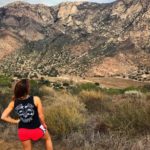
The first part of the journey is very steep but short, getting your heart thumping almost immediately. Continue upward about .25 miles until you reach a junction with the other branch of the trail. Keep going straight to continue the climb uphill. The next half-mile will be challenging, in fact you may even feel winded, however, there’s a small stretch of downhill and flatness to come. You will pass by a flat clearing used as a helicopter landing spot where you can take in spectacular views of El Cajon Mountain and Cuyamaca Peak in the distance on a clear day.
Soon after you’ve had a chance to catch your breath, a prolonged sequence of uphill climb will soon come into play. With proper gear, you can trek this strenuous portion quick and fast to get it over with, which is what I prefer when I hike.
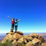
Finally, just when you think it can’t get any harder, you will reach the summit. The summit may look very familiar to other hikes in the area (ex: Cowles Mountain), however the main difference is you won’t be surrounded by tons of people due to the relative solitude.
To return back to the trailhead, simply retrace your steps. The descent downhill is just as steep — go slow and take steady steps. There is a lot of loose dirt and it can be easy to lose your footing.
Like most hiking paths in Mission Trails Regional Park, many come to this nature hotspot for the San Diego River, historic Mission Dam, areas of lush grasslands, wildlife, and miles of trails. Nearby, the Kumeyaay Lake was even once part of the Marine Corps Camp Elliott, which used the surrounding land as training ground. After the military cleared house and deeded the land back to the city, the area around the lake underwent massive restoration to remove unexploded munitions and to reforest the riparian vegetation surround the lakes and river. It’s hard to believe the area near the river was once barren and deforested. Today the area is alive with willows, cottonwoods, oaks and sycamores. More history on Mission Trails Regional Park can be found here.
Kwaay Paay Summit Tips
Tip 1: Due to the relative solitude of this hike, you are more likely to run into snakes. I’d recommend wearing hiking boats rather than shoes for this hike due to this.
Tip 2: On clear days take in downtown, La Mesa, La Jolla, Coronado, and Point Loma in the distance.
Tip 3: Plan to exit by 7pm when the main gate closes or you may be towed or cited.
Tip 4: Having trekking poles would be useful in maintaining balance and providing extra support.
Tip 5: Wear light colored clothing and layers if you will be hiking in the summer. There are not a lot of shaded portions of this trail, especially in the beginning of the hike.
Driving Directions(From Downtown San Diego): Drive north about 9 miles on SR-163 and turn east on SR-52. Drive 6.5 miles and exit on Mast Blvd., turning left under the freeway and then right on West Hills Parkway. Drive 0.7 mile to Mission Gorge Road and turn right. Proceed 0.3 mile on Mission Gorge Road and then turn right again on Father Junípero Serra Trail. At 0.2 mile, there is a dirt parking lot on the corner of Father Junípero Serra Trail and Bushy Hill. The trailhead is 0.2 mile further, past the entrance to the park and to Kumeyaay Lake and Campground, on the south side of Father Junípero Serra Trail.
Trail Difficulty: Moderate to Strenuous
Total Distance: 2.2 miles
Trailhead Address: Bushy Hill and Father Junípero, San Diego, CA 92119


Not cool. the text has been stolen from http://tinyurl.com/onw3vea
Thanks for the informative writing. Definitely will visit one day ..solo hiking