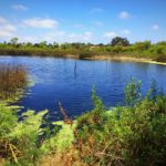
Kitchen Creek Falls Trail is not only easily accessible, but also offers a walk along the infamous Pacific Crest Trail (PCT) and concludes with a seasonal waterfall. Located in the Cleveland National Forest, catching a glimpse of the falls is easiest after rain has fallen in Southern California and can be an incredible sight to see with a cumulative drop of 150 feet amid desert-like terrain. Located just 50 miles east of San Diego and close to the Interstate 8, Kitchen Creek Falls can be easy to miss if you don’t research exactly how to get there. Fear not, I’ll give as much detail as possible to help you find this desert gem.

After parking in a turnout along Highway 80, you will cross the street to reach the trailhead for Kitchen Creek Falls.

Park here

Kitchen Creek trail begins here
There is not a noticeable sign or kiosk that marks this trailhead, however the path is easy to find once you cross the street. Soon after beginning your journey to Kitchen Creek Falls you will encounter a trail post in the ground and another PCT marker in a nearby tree, letting you know you’re on track. The first 2 miles along the Pacific Crest Trail are easy to navigate and straightforward, passing underneath the busy I-8 before the trail climbs alongside fences.

Gate near the beginning of the trail

Just after passing beneath the second I-8 bridge, turn abruptly right and ascend several switchbacks up the slope. Here you will begin a gradual ascent through chaparral and white-flowered ceanothus and manzanita in the spring. At about 0.5 miles, the noise of the freeway will start to fade and instead you’ll hear the call of nature instead (foliage rustling with the wind, water lapping in a small stream, animals scurrying in the brush).

At 2 miles, you will come across an easy-to-miss spur trail, which leaves the PCT). Look for a narrow side-path on the left. This trail splits into several branches. Unfortunately, there is not a clear cut path to get to Kitchen Creek Falls, however you will want to stay to your left and wander down the ridgeline just south of the creek to falls area. After a short scramble, you will begin to hear the sound of the waterfall, which is helpful in guiding you closer to the stream. You will find yourself at the top of the falls, where you will need to complete a very steep scramble to get to a more satisfying view of Kitchen Creek Falls.

After you’ve had your fill of the waterfall, re-trace your steps by scrambling back uphill, and meeting up with the Pacific Crest Trail once more.

Kitchen Creek Falls Tips
Tip #1: This trip, like many others in the Laguna Mountains, requires a National Forest Adventure Pass for parking at the trailhead. Adventure passes can be purchased from any national forest office or ranger station, most outdoor equipment and sports vendors, or call 619-445-6235.
Tip #2: Watch your step around slippery rocks and be aware of possible rattlesnakes in the area, particularly during the rock scramble portion of this hike.
Tip #3: Do not solo hike to Kitchen Creek Falls if this is your first time. The falls can be difficult to find and it is easy to get lost.
Tip #4: The best time of year to see the falls in action is during the spring, particularly March-May or after winter rainfall.
Tip #5: Keep an eye out for poison oak.

Elevation Gain: 900 feet
GPS Coordinates for the Falls: 32.7429962158203, -116.466186523438
Difficulty: Easy
Total Distance: 4.5 miles

Driving Directions
Take Interstate 8 East from San Diego for roughly 50 miles to the Buckman Springs Exit. Turn right at the exit. At the intersection turn left to take Old Highway 80. Drive 2 miles and park in a large pullout on the right side of the road, what was once the Boulder Oaks store. Park at this pullout and cross the street to reach the PCT.


Photo Credit: Lhogue46


