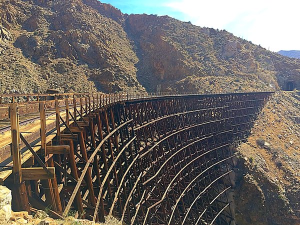
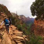
There may be 66 miles of hiking trails to explore in Letchworth State Park but if you only have minimal time to explore this East Coast gem, the 7+ miles along the Gorge Trail are the most spectacular to trek along. Along the west side of the Genesee River, the Gorge Trail passes by 3 sweeping waterfalls, a railroad trestle, and numerous breathtaking view points. The trail winds nearly 8 miles through streams and forests, passing several overlook points to view the far side of the gorge and the Genesee River below. The terrain is easy to moderate, and the trail is well-maintained and marked with yellow blazes with the number 1 on the blaze to guide you along the way.

The glacier-carved gorge responsible for Gorge Trail’s name, is nestled in the western part of New York State between Buffalo and Rochester, surrounded by a wilderness park. The locals refer to the gorge as the “Grand Canyon of the east” and although it may not be on the same massive level as the popular Arizona attraction, it is still an impressive site to take in. It should be noted that the Gorge Trail is not a loop, and getting to the end of it leaves the hiker stranded seven miles from their car. Some hiking groups conquer this by leaving another vehicle at the end of the trail at the St. Helena picnic area.

7-Mile Thru-Hike Option/14-Mile Round Trip
Known as the most popular hiking trail at Letworth State Park—and for good reason—the trailhead for the Gorge Trail begins at the parking area near the Portageville entrance at the southern end of the park. The trail starts across the road from the parking area. The trail traverses beneath a railroad trestle and descends toward Upper Falls. Soon you’ll cross the usually low Degenawanus Creek. On your left you’ll spot the 15-foot Shadow Falls and on your right, below you’ll catch a glimpse of the 15-foot Degewanus Falls. Soon you’ll approach the Middle Falls.

Compared to the relatively short distance between the Upper Falls and Middle Falls, the journey to the 55-foot Lower Falls is much longer. The gorge begins to deepen in this area and become sketchy. While some sections of the Gorge Trail have protective walls and fences, other sections are surprisingly unprotected. One misstep and you could potentially plummet into the gorge below. However, this can easily be avoided as the trail is very wide in most sections—simply put yourself at a safe distance from the rim and continue your hike at this distance. Climb down the 127 steps to the Lower Falls lookout point to capture some photos and bask in the beauty of the waterfall.

Middle Falls
5.2-Mile Round Trip Option
If a 14-mile round trip journey sounds a bit unbearable or you don’t want to take two cars, there is also a 5.2-mile round trip trek you can take that begins at the Lower Falls parking area. From the parking lot veer left at the trail junction near the concession stand and restroom building. Climb down the 127 steps to take in the Lower Falls before heading back up the steps and turning right at the junction. 1 mile along the Gorge Trail you’ll reach more stone steps, but this set is much shorter than the set to the Lower Falls.

Lower Falls
At 1.6 miles you will reach Inspiration Point—arguably the most famous view in the park. Looking southwest, two of the three waterfalls can be seen: Upper and Middle Falls. Past Inspiration Point you will gradually climb to reach the highest point of the hike.
At 2.4 miles the trail crosses a steep ravine on a sidewalk built next to the park road. On the south side of the bridge, you leave the main park road for an overlook of the gorge, cross the upper/middle falls access road, descend down stone steps and cross the access road again to reach the overlook for Middle Falls. Follow the pain blazes carefully at these turns. At 107 feet high, Middle Falls plunges over several layers of rock with enough volume to create a rainbow in the mist.

On top of Upper Falls
3 miles into the hike you will arrive at the viewing platform for Upper Falls. This 71-foot waterfall is perhaps best distinguished by the active railroad trestle that sits above it. The Gorge Trail continues past Upper Falls another 0.2 miles, but most of that distance involves climbing more stone steps and no other main interest points. This is where it is recommended to return back to the Lower Falls trailhead and retrace your steps.

View point
Gorge Trail Tips
Tip 1: The Portageville Entrance is closed during the winter.
Tip 2: Exercise caution when taking pictures/exploring the falls. It is unnecessary to cross walls or fences to get a spectacular view, it can be seen safely from the trail.
Tip 3: Central New York Hiking recommends taking two vehicles or a shuttle, parking one at the Mary Jemison Parking Area and the other at either St. Helena picnic areas, finishing your hike at St. Helena.
Tip 4: Entrance to the park is $8. Parking attendants are helpful in providing directions and trail maps.
Tip 5: Each of the falls (Upper, Middle, Lower) has it’s own parking area near the trail with picnic tables, restrooms, and gift shops.
Tip 6: This trail is probably not suitable for small children. There are many sections where an individual could simply walk right into the gorge. While this hiking destination is beautiful, it holds a decent amount of danger for small children.

Trail Difficulty: Easy to Moderate
Total Distance: 7 miles, 14 miles, or 5.2 miles
Letchworth State Park Address : 1 Letchworth State Park, Castile, NY 14427
GPS Coordinates: N 42.57216 W 78.05213


