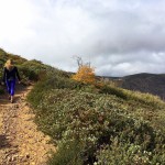
Escape the shrubby, boulder-packed scenery of San Diego and escape to Palomar Mountain, and more specifically the French Valley Trail to Weir Trail.

Palomar Mountain is a rarity in San Diego: a State Park where you can experience all four seasons. At over 5,000 feet elevation, it has breathtaking views of meadows, mixed conifer forest, rich plant diversity, and historic sites. Wildlife is also prevalent here, including black-tailed mule deer, gray squirrel, mountain quail, Stellar’s jay, and bobcats. Much of this biodiversity can be experienced by hiking the French Valley Trail to the Weir Trail.

To get to the trailhead for the French Valley Trail, you will leave the parking lot and walk towards the campgrounds (just beyond site #25). Veer left and travel down the paved road where a small bridge and wooden kiosk will come into view. A box contains guides for the trails in the near vicinity (a $.25 donation is suggested) to help guide your journey. The trailhead for the Lower Doane Valley Trail will also be here. Follow the marked signs for the French Valley Trail and continue forward.

Along the trail you’ll peek in and out of pines, oaks, firs, and shrubs. You’ll also pass ancient oaks, some of which have grown over large granitic boulders for support. Your first obstacle will be a fallen oak tree, which has been sliced open to allow for a hiking path. Skirt through the fallen tree and reenter the oak forest.


Soon after, you’ll come across a massive old oak tree, with a canopy of thick branches that blocks the light overhead. Here is a prime opportunity to capture some amazing pictures on top of the giant oak’s branches. Follow the trail forward, passing in and out of oak lined tunnels, alternating with open patches of grass and the occasional boulder.

After about a 0.75-miles, the trail loops back to the left and will follow the edge of the expansive meadow. The meadow holds your best opportunity for spotting deer. After a massive rainstorm, herds as large as 25 deer can be found grazing in the tall grasslands. This stretch is long, but the views of the meadow dotted with Ponderosa pines is beautiful enough to make you forget you’re even walking.


Before you know it, you’ll be at a junction for the Lower Doane Trail. If you turn right here, you will head in the direction of Doane Creek. If you turn right again just before Doane Creek, a spur trail will take you out and back to the weir, a historic site worth checking out. The Weir is an old gauging station built in the 1920’s to measure the flow of water and determine whether it could be harnessed as a source of hydroelectric power. The low proved to be inadequate, and instead the weir was left behind for ruins. After you’ve climbed inside the weir or just enjoyed the tranquil pool of water nearby, retrace your steps to the last intersection and follow the signs for the Weir Trail to Doane Pond.

The trail will continue through lush trees, most of which are pine and cedar. This portion of the trail is eerily quiet, with the occasional sound of a woodpecker pecking nearby or a squirrel running through the thick litter of leaves and snow. This is where your small ascent will kick in. The trail ends with a short steep section up stone steps and over a shallow creek crossing. Cross the main park road to a short bridge crossing and the trail will emerge into the parking lot, completing your loop. Here you can continue onto the Thunder Spring Trail to Upper Doane Trail or simply head back to your car.

French Valley Trail Tips
Tip #1 : The rocks near the Weir are slippery after rain and in the winter. Exercise caution when crossing them.
Tip #2 : Tread lightly and keep your eyes open for deers feeding in the expansive meadow.
Tip #3 : You must pay an $8 day-use fee (at time of wring) to hike this trail. You will pay this fee at the State Park entrance.
Tip #4 : Dogs are not permitted on this trail, although I did come across a few while hiking here. I’m not sure how strictly enforced this policy is but you’ve been warned.
Tip #5 : Hike the Thunder Spring Trail near Doane Pond to make the most of your time here. This will tack on approximately 3 more miles onto your trip.

Driving Directions:
Take I-15 north. Turn right onto CA-76 East exit. After approximately 6 miles, make a slight left onto S Grade Rd/Palomar Mountain Rd. Turn left onto S Grade Road, then turn left again onto State Park Road. Follow the road to the State Park entrance where you will stop and pay your entry fee. Then follow the road down to the Doane Pond parking lot.

Elevation Gain : 745 Feet
Difficulty : Easy
Total Distance: 3.8 miles
Trailhead address: 19952 State Park Drive Palomar Mountain, CA 92060


 Los Penasquitos Canyon Preserve Trail | San Diego, CA
