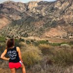
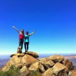
Rancho La Costa Preserve offers north county visitors a convenient option for an after work or weekend hike. Nestled in the suburbs of La Costa, there are four different trails ranging in both difficulty and length. The preserve, managed by the Center for Natural Lands Management, also includes close to 500 acres of non-developed, protected habitat. My favorite trail in Rancho La Costa Preserve is the Denk Tank Mountain Trail, a 4-mile trek up switchbacks that offers panoramic views of the Batiquitos Lagoon, the Pacific Ocean, and the city of San Diego.

To reach the trailhead, first park along Corte Romero street. The trailhead will be at the very beginning of the street, where you’ll see a wooden trail marker with a pouch for informational brochures. Continue to follow the trail as it begins its initial ascent uphill. You’ll almost immediately cross a short wooden footbridge, etched with the rules of the trail. The bridge warns hikers have the right of way. This is largely because mountain bikers frequent this trail, and it’s likely you’ll encounter quite a few on your way up.


You’ll reach your second trail marker shortly after you begin your hike at a “T” junction. Ignore the marker for Sitio Salvia and instead continue straight following the sign for the Switchbacks Trail to stay on course. At around 0.5 miles you’ll reach a “Y” junction. Stay to your left to continue the Switchbacks Trail.

The trail becomes very straightforward from here, slowly gaining elevation through a series of switchbacks. Because of these switchbacks, we could hardly notice the elevation gain and the trail never felt too difficult, even as we began to climb higher and higher. Most of the climb we were also rewarded with breathtaking views of the surrounding city of Carlsbad and the glistening Batiquitos Lagoon in the distance.


Just before reaching the 1-mile marker, you’ll pass through an outcropping of boulders, a great spot to take in the views or take a break if needed. This is one of the only parts of the trail where you’ll find shade, so it may be an opportune time to cool off if hiking in warmer months.

At a little over a mile you’ll encounter a sign for the Mule Deer Trail. One could take this trail and still reach the top of Denk Mountain. I’d suggest taking this trail either on the way up or on your way down to switch up the scenery. We decided to continue the Switchbacks Trail for now, knowing we would take the Mule Deer Trail on our way back down.

At 2-miles, you’ll reach a 4-way junction. You’ll also likely be able to see a wood awning in the distance. Follow the trail straight toward the awnings to complete your hike to the summit of Denk Tank Mountain.

At the top you’ll find two benches and a picnic table where you can sit and relax in the shade. Additionally, there is a work station for mountain bikers where they can fix their bike or add more air to their tires if needed. Although I’m nowhere near a mountain biker, I thought this was a unique feature and something I’d never seen before on a trail.


After admiring the views, you have the option to retrace your steps back to the trailhead. Alternately, you can take the Mule Deer Trail to get a divergent vantage point. It is important to note the Mule Deer Trail does not gradually ascend along switchbacks, but instead cuts downhill quickly, shaving off some of the distance and getting you back quicker. Eventually the Mule Deer Trail meets back up with the Switchbacks Trail to take you back to your car on Corte Romero Street.

Denk Tank Mountain Tips
- Wear sun protection. Almost the entirety of this trail is exposed and without shade.
- Watch out for mountain bikers. You will more than likely run into a few. Pay extra caution when rounding switchbacks.
- Bring plenty of water. There are no spots to refill your water on this trail.
- Use the restroom prior to hiking. There are no restrooms at the trailhead.
- Bring a picnic lunch. There are a few benches and a picnic table at the summit for you to eat lunch while enjoying the breathtaking vistas.

Driving Directions
From downtown San Diego, take CA-163 N. In 6.2 miles, use the right 2 lanes to take exit 7A to merge onto I-805 N toward Los Angeles. In 8.9 miles, merge onto I-5 N. In 11.3 miles, take the Leucadia Blvd exit.
Turn right onto Leucadia Blvd. In 1.8 miles, continue onto Oliverhain Rd. In 1 mile continue onto Rancho Santa Fe Rd. In 1.9 miles, turn right onto Camino Junipero. In 0.2 miles, turn left onto Corte Romero. The trailhead will be to your right as soon as you turn onto Corte Romero. Park along the street.

Elevation Gain: 1,000 feet
Difficulty: Easy to moderate
Total Distance: 3.5 miles
Trailhead Address: 3537 Corte Romero, Carlsbad, CA 92009
Dog Friendly: Yes


