It’s hard to believe that in the San Gabriel Mountains near Pasadena, California, approximately five miles into a trail that follows the San Gabriel River, lies a 120-foot bridge to nowhere. An even stranger idea is that there is bunjee jump that allows risk-takers to plunge down off this abandoned bridge towards the rushing river below.
Constructed in 1936 north of Azusa, this arch bridge was meant to be part of a road connecting the San Gabriel Valley and Wrightwood until the project was nixed. The East Fork Road was under construction when it was washed out during a large flood March 1-2, 1938. The East Fork Road project was abandoned as a result of the flood, leaving the Bridge to Nowhere forever alone in the middle of the Sheep Mountain Wilderness (source).
The East Fork Trail, a.k.a. the trail you take to Bridge to Nowhere, starts at Coyote Flat past a locked gate at the end of East Fork Road. Walk around the gate and follow the wide dirt road. While strolling along the dirt road, don’t forget to observe the surrounding landscape which is truly beautiful, especially in the spring. The dirt road comes to an end at the junction with Heaton Flats Trail. Skip this trail as it will lead toward Iron Mountain, and continue along the road. It will begin to narrow quickly and this is when you will begin to encounter the water.
There are many parts of the trail where you can choose between walking in the loose sand of the river’s flood plain, or follow the footpaths on higher ground. Stay on the river’s eastern shore, walking along the boulders as you proceed north. When the river makes makes a slight bend, you will cross the river to the western bank and ascend a low rocky ridge, away from the river. Don’t worry you won’t be away from the water long.
The second river crossing will come just after a brushy area, and on the east bank, the trail splits into several trails that continue north. Several of these paths are marked with cairns. There isn’t one universal route to take, however they all go to the same place, so continue to follow the river.
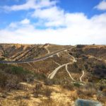
The trail stays east of the river at the junction with Shoemaker Canyon — noticeable if you look up at the western mountains and see the final tunnel in the abandoned Shoemaker Canyon Road. If you look down you will see the overgrown asphalt of the failed San Gabriel River Road. After passing this , the trail turns northeast and crosses the river twice.
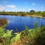
When the river reaches Laurel Gulch, it makes a sharp turn north once again. The trail follows the river, and passes a sign for the Sheep Mountain Wilderness area. Here the trail will enter a broad dry wash in the river until you reach the nearby Allison Gulch. You will cross the river twice again north of Allison Gulch — an area suitable for swimming if you wish.
The trail will leave the water once again and meets up with another section of broken-down pavement. This portion of the trail is distinct and easy to follow. Keep following it north until it descends back down to a rocky area of the riverbed. Here is where it is easy to get lost. There are several marked paths that leave the riverbed back upward to the old road ridge. Ignore these paths and continue to follow the river.
After two crossings, continue northeast, toward the higher road grade. There is a path with a short scramble to join this route. After this, the route is relatively easy the rest of the way. There will be some elevation gain through brush as the old road grade gets further above the water and a few steep drop-offs. After passing a small, metal cabin the bridge will come into your view. A little bit further and you will be there!
Continue across the bridge while admiring the brave bungee jumpers dive to the depths below. A little bit further you can scramble down a use trail to some of the better swimming holes along the trail or stop and eat a hearty lunch.
Although the elevation gain isn’t too daunting on this hike, the distance will definitely leave your legs sore the next day and make for a grueling workout. Remember to have fun, enjoy the scenery, and pat yourself on the back once you’re done for a great accomplishment many have trouble completing!
Bridge To Nowhere Tips
Tip 1: Bring plenty of water and apply sunscreen as a considerable portion of the trail is exposed to direct sunlight.
Tip 2: The parking lot generally fills up by 9 am on the weekends. For a close parking spot, arrive before 9 am or expect to park farther away.
Tip 3: Wear waterproof shoes if possible. There are many portions of this hike where you will need to cross the stream.
Tip 4: Make sure to go past the bridge towards the water, there are small waterfalls and swimming pools. This is also an optimal place to take a lunch break.
Tip 5: Pack a swimsuit or wear one under your hiking gear to take advantage of the small pools near the bridge on a warm day.
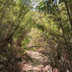
Tip 6: There are minimal signs along the trail and it is easy to feel lost. Luckily, all paths following the water eventually lead towards the bridge.
Tip 7: A private company known as Bungee America offers bungee jumping options off the bridge, if you dare. There is even a night package for thrill seekers looking to take near-death to the next level. More information on this experience can be read by clicking here.
Tip 8: You’ll need a free Wilderness Permit to hike to the Bridge to Nowhere. You can get one at a self-service registry at the trailhead, visitor center in the Angeles National Forest, or any manned ranger station.
Difficulty: Moderate to Difficult
Total Distance: 10 miles
Trailhead address: Sheep Mountain at East Fork Rd, Azusa, CA 91702
Driving Directions: From the 210 freeway in Azusa, take exit 40 north on Route 39. Drive 11.6 miles north, passing the East Fork Ranger Station at the base of the San Gabriel Mountains. Pass San Gabriel Reservoir and turn right on East Fork Road. After 5.2 miles, when the road makes a sharp bend to the right, continue straight ahead on Camp Bonita Prairie Forks Road, sticking with the river for an additional 3/4 of a mile to the trailhead parking area.
