San Diego’s most popular peak can be accessed along a far less crowded, yet equally as enjoyable trail. Many San Diego residents are familiar with Cowles Mountain, one of the most easily accessible peaks in central San Diego. Yet few are aware of the Big Rock Trail, which winds up the back side of Cowles Mountain, taking you up to the same destination. The Big Rock trail adds a few extra miles in length, yet ranks about the same in difficulty as the main trail up to the Cowles Mountain summit.

The Big Rock Trail picks up on the outskirts of Big Rock Park, past the park itself and behind the tennis courts. The trailhead is marked by a single wooden kiosk and a sign that reads “Big Rock Trail”. The initial start of the Big Rock Trail is pretty straight forward until about 0.2 miles in where you have the option to continue following the main trail as it curves a hard left or cross a dried creek bed straight ahead. Cross the dried creek bed, stepping over several small rocks to approach a dirt multi-use trail once again.

Trailhead

Cross creek bed here
After crossing the dry creek, the trail is very straightforward and easy to follow. You’ll continue uphill, walking along a steady series of switchbacks. While you’ll gain a decent amount of elevation on your ascent, it never felt terribly difficult thanks to the switchbacks. The trail is also mostly shaded thanks to brush overgrowth and manzanitas, providing adequate sun coverage.


Shortly after one mile you’ll come to a junction. To your left will be the Mesa Trail, another alternate trail to get to the top of Cowles Mountain.

You’ll want to turn right to continue your ascent to the summit, following the sign that reads “Big Rock Trail”. You will continue to climb for a short distance, and then you’ll be able to give your legs some reprieve during a short downhill jaunt.
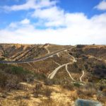
At 1.5 miles the Big Rock Trail will come to an end and you’ll reach a wide service road. Turn right once again. This is where the real challenge begins. The climb uphill from this point is slightly daunting and unrelenting. The gravel is loose, elevation gain is tiring, and your glutes will likely be burning. After 0.4 miles, the trail will slightly level out before you tackle your one last beast of an uphill climb.

When you see the expansive Lake Murray glistening in the distance, you’ll know your journey to the summit has almost come to an end. Continue just a short distance further to reach the top of Cowles Summit. When you reach the top of the service road, to the right you’ll find your first viewpoint. This offers views of El Cajon Mountain, Mount Woodson, and the city of Santee far below you.
After admiring the sweeping views at this point, continue just a few steps further on the service road and climb a short sequence of wooden steps to reach Cowles Mountain Summit. You’ll likely be greeted by dozens of hikers who hiked the main trail.

While Cowles is the most popular hike in all of San Diego, it is not without good reason. The views from the summit are remarkable, and one of the only in San Diego that provide such a large vantage point of the cityscape.
To reach the trailhead, simply retrace your steps back down the service road to the Big Rock Trail.

Big Rock Trail Tips
Tip #1: Bring trekking poles. They will be helpful during your final climb on the service road.
Tip #2: Bring your dogs. This trail is very dog-friendly with adequate shade coverage and dog bowls with water at two different stops on the trail.
Tip #3: Ok for solo hikers. Although this trail sees far less foot traffic than the main trail, there will still be a decent amount of people hiking, making it safe to hike alone.
Tip #4: Wear sun protection. The service road portion of the trail is entirely unshaded.

Driving Directions
From downtown San Diego take CA-163N for 8.8 miles. Take exit 9A to merge onto CA-52 E. Take exit 14 for Mission Gorge Road. Turn right onto Mission Gorge Road. Continue on Mission Gorge Road for 0.8 miles. Turn left onto Big Rock Road. Follow Big Rock Road for 0.7 miles. Park along the right side of the street near the tennis courts.

Elevation Gain: 1,192 feet
Difficulty: Moderate
Total Distance: 4.2 miles
Trailhead Address: 8125 Arlette St, Santee, CA 92071
Dog Friendly: Yes
Big Rock Trail: Map


