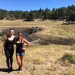
Some hikes are epic enough to warrant a lengthy drive. The Big Horn Mine Trail is one of them. It’s nearly a 3-hour drive from San Diego yet entirely worth every minute in transit. Located just past the Mountain High Ski Resort in Wrightwood, the Big Horn Mine biggest draws are the remains of a miners’ cabin and two closed mines. It also offers visitors a glimpse into Southern California’s rich mining history.

On the eastern slope of Mount Baden-Powell, the Big Horn Mine was first discovered by Tom Vincent, a local man hunting big horn sheep. These sheep led him to discover a prosperous gold mine, which yielded over $100,000 in gold while in operation. Mining here ceased after the price of gold dropped. Interest in opening Big Horn Mine piqued again in 1985, however it was determined it was not feasible to resume mining the Big Horn. As of now, there are no plans to reopen Big Horn Mine, but should the price of gold rise again, it wouldn’t be out of the question.


The trailhead for the Big Horn Mine Trail picks up in the Vincent Gap parking area, off to the left of Highway 2 past Wrightwood. This is the same parking area for the Mount Baden-Powell Trail, a 8-mile trek with stunning views. We will save that trail write up for a different day.

To reach the Big Horn Mine, follow the initial signage for the Mine Gulch Trail, veering to the left after passing by the white metal gate. After a short distance, the dirt trail will split. Take the junction to the right, marked with a sign that reads “Big Horn Mine 2 mi” to continue your trek uphill. From here, the trail is very straightforward with no more junctions.


The trail will slowly wind uphill, never becoming too difficult as far as elevation gain is concerned. There are several points where the trail narrows and becomes rocky. You’ll need to tread slowly here, making sure to be extra careful. Hiking boots with good traction are useful to wear on this hike for this reason.

At approximately 1 mile into your hike, the surrounding trees will become less thick and present you with sweeping views of the nearby mountains. We hiked here in May after heavy rainfall and the mountains were still capped in snow, making the view even more astounding.

Aside from the stunning vistas, your first major point of interest will come up on your right, a small mine outlet. Unfortunately, like other popular hikes, this trail has suffered some graffiti, prevalent here and at the actual Big Horn Mine. This mine outlet is boarded up and you cannot enter here. It is still interesting to stop and explore nonetheless before proceeding back uphill.


Continue to follow the trail until you reach the actual mine itself, a large wooden structure slowly decaying with time. Use caution when stepping on the wooden planks as some have come unbolted and are no longer properly held down.


To see the entrance to the mine, there are two side trails to the left and right of the large wooden structure. I found the trail to the right to be easier to climb up. From here you’ll need to climb up several unstable pieces of wood to reach the mine entrance. This is very dangerous and I would highly recommend not checking out the mine if you are hiking with children. It is not boarded up so you can potentially go inside and walk through the mine, however, again I can’t recommend this because it’s dangerous.


Once you’ve had your fill of exploring all the Big Horn Mine has to offer, retrace your steps downhill to the Vicente Gap parking area to return to your car.

Big Horn Mine Trail Tips
Tip #1: Wear sturdy hiking boots. There are a few parts of this trail that are narrow and require you to walk on a rocky cliffside.
Tip #2: Hike in Fall, Spring, or Summer. There is snow here in winter, making this hike more dangerous with icy trail conditions.
Tip #3: Use caution if you plan to enter the mine. The wooden planks leading up to the mine are unstable and so is the mine itself. Trying to climb up here and entering could result in death.
Tip #4: Because of the limited elevation gain, this hike is suitable for children so long as parents watch them closely, especially on the narrow parts of the trail. Do not allow your children to enter or climb up to the mine.
Tip #5: This hike is OK for solo hiking, especially on weekends. We saw about 30 different people on the trail and up at the mine.
Tip #6: Pick up a $5 Adventure Pass and display it on your dashboard to avoid paying a fine.

Driving Directions
From downtown San Diego, take 163-N for 11.2 miles. Merge onto I-15 N. Stay on I-15 N for 44.8 miles. Just past Temecula, keep right at fork to continue on I-215N, follow signs for Riverside/San Bernardino. Drive 34.7 miles. Keep right at the fork to stay on I-215 N, follow signs for Main St/Interstate 215 N/San Bernardino/Barstow. Keep left at fork to continue on Barstow Fwy/Mojave Fwy, follow signs for I-15 N/Barstow.
Merge onto I-15N/Barstow Fwy/Mojave Fwy for 6.9 miles. Take exit 131 for CA-138 toward Palmdale/Silverwood Lake. Turn left onto CA-138 W. Turn left onto Lone Pine Canyon Road. In 8.7 miles, turn right onto Sheep Creek Drive. In 0.5 miles turn left onto CA-2 W. You will drive through the town of Wrightwood, past Mountain High Ski Resort and the Grassy Hollow Visitor’s Center.
Park in the Vincent Gap Parking area on the left side of the freeway, the same lot you’d park to hike Mount Baden Powell. A $5 Adventure Pass is required.

Trail Difficulty: Eassy to moderate
Total Distance: 4 miles
Elevation Gain: 500’
Trailhead Address: Big Horn Mine Rd , Azusa, CA 91702


