Where’s the only place in San Diego you can hike to remnants of a World War I plane crash? On the Airplane Monument Trail in Cuyamaca Rancho State Park. A quick 5.5-mile round trip hike will take you to the remains of a twin-seat Army DeHaviland DH4B model biplane that crashed in San Diego on December 7, 1922. All that remains is the rusted, weathered plane engine, which now serves as a monument dedicated to the fallen Col. F.C. Marshall and 1 st Lt. C.L. Webber.

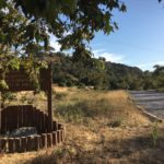
The trailhead picks up in the Sweetwater parking area about 0.5-miles north from the Green Valley campground area. There are several trails that pick up here, which is why it is important to look for signs for the West Side Trail. Follow the West Side Trail beneath the Sweetwater Bridge, where you’ll cross a small pool of water.


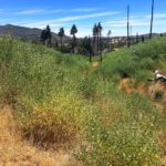
Continue to follow the West Side Trail, beneath patches of old oaks and pines that survived the 2003 Cedar Fire. The trail will parallel CA-79 briefly, before transporting you away from the noise of the freeway and into the shaded oak forest.


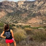
After 0.6-miles the West Side Trail will reach a junction. Follow the signs for the Monument Trail, where your uphill ascent will begin. Luckily, albeit rocky at times, the elevation is steadily gained over the next two miles, making the climb moderate in difficulty. Surrounding views of Stonewall Peak and the greater Cuyamaca Rancho State Park in the distance are a good distraction to your cardio.


When you reach the top of the ridge, you’ll see one last sign directing you toward the airplane monument. Follow the sign to find the remains of the DH4B plane’s engine, decorated with a placard that reads, “In memory of Col. F.C. Marshall and 1st Lt. C.L. Webber who fell at this spot Dec. 7, 1922.”

Once you’ve paid your respects and admired the landscape, you’ll have two options: re-trace your steps back to the trailhead for a 5-mile hike or complete a 5.5-mile loop by continuing north and taking the West Mesa Trail to the Japacha Fire Road.

To complete the longer loop, continue north on the West Mesa Trail until you reach a junction. Turn right at the junction, heading back in the direction of the SR-79 freeway. Follow this trail for 2 miles until you reach yet another junction for the Japacha Fire Road. Continue on the fire road until you reach the West Side Trail once more, which will take you under the Sweetwater Bridge and back to the parking area.

History
Webber and Marshall set out in their doomed plane on a fact-finding inspection tour of cavalry posts in early December. Marshall was a World War I Veteran; Webber was considered an expert pilot in days when aviation was just taking off. When the two military officers failed to reach their destination on December 7 th , a large search ensued.
“By Dec. 17, the search for Webber and Marshall had evolved into the largest combined air and ground search in U.S. military history during peacetime,” Alexander D. Bevil wrote in the Journal of San Diego History .
It took nearly five months to find the site of the plane crash and the pilot’s remains. On May 4, 1923, local rancher George W. McCain stumbled across the wreckage while riding his horse along Japacha Ridge.
A memorial was dedicated to the two fallen soldiers in May 1923 and refurbished by Civilian Conservation Corps workers in 1934, who also are responsible for creating the Airplane Monument Trail. In 1968 the state parks improved the monument.

Airplane Monument Trail Tips
Tip #1: Watch where you step. Since this is a multi-use trail, you’ll likely encounter plenty of horse poop.
Tip #2: Be careful near the monument. There are many bees on, near, and surrounding it.
Tip #3: There is one restroom facility available in the parking lot near the trailhead.
Tip #4: Follow the trail markers. There are a number of different spur trails along the way and it could get easy to get lost if you’re not paying close attention.
Tip #5: For a shorter trek to the Airplane Monument, you may alternately park in the Green Valley area campground. At the time of this post, there is a $10 day-use fee to park here.

Driving Directions
From downtown San Diego take I-8 E for 22.2 miles. Take exit 40 for CA-79 N/Japatul Valley Road toward Julian. Turn left to stay on CA-79 N. Drive 0.5-miles past the Green Valley Falls Campground, just before the Sweetwater Bridge. Park in the large dirt parking lot, marked by a blue sign that will read “Parking”.

Elevation Gain : 800 feet
Difficulty: Moderate
Total Distance: 5.5-miles


