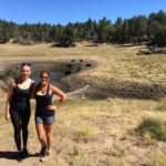
A mere 45 minutes away from central San Diego lies a plethora of picturesque hikes in Laguna Mountains. Despite its relative proximity to San Diego, many locals aren’t familiar with Laguna Mountains, which make it an ideal destination for those looking for a quick escape away from the city. Due to its higher elevation and fair share of precipitation, this region supports Jeffrey pines and black oaks. The Agua Dulce Trail features these two types of trees as well as the incense cedar. For a comprehensive introduction to the Laguna Mountains region, the 6-mile Agua Dulce Trail is a good place to start.

Before tackling the Agua Dulce Loop trail, first you must pick up a National Forest Adventure Pass ($5 for the day). After picking up your adventure pass and displaying it in your windshield, you will start your hike at the Meadows Information Station, just 0.1-miles past mile marker 19 on Sunrise Highway. Park on the wide road shoulder. Pay caution to parking signs as there is one section near here where cars are not permitted to park.


Cross the street and walk towards the iron gate. Proceed along the trail for 0.2 miles until you reach a junction. Follow the narrower trail to the right marked “Old County Road”. At .25 miles you will reach a “T”. Follow the “T” to the left and away from the freeway. The road will soon turn from dirt to pavement. This is the less scenic part of the trail, but do not fear, there are far greater sights to be seen coming up soon. Continue to follow the road as it slightly ascends uphill.


At 1.67 miles, you’ll pass through an open gate. Shortly after you will find a spur trail to your left. This can be easy to miss so keep your eyes open at 1.87 for a sign that reads “Chico Ravine” and follow this trail to the left. This is where the beauty of this hike truly comes to life. You’ll first pass through an open meadow, surrounded by staggering pine trees on both sides.


At 3-miles you will find yourself following the trail through an open field. We found several cows grazing freely here. We maintained our distance although they seemed harmless and more concerned with munching on the grass beneath their feet. At 3.4-miles you will come to a “Y” junction. To your left is a small family cemetery and a bench look out point. We stopped here in the shade and ate some of our snacks while admiring the views around us. If you want to skip the resting stop, continue right at the “Y” and continue to follow the trail as it weaves through the open meadow. Soon you’ll be making your way back towards the trees.


Cemetery


Rest stop
At approximately 4-miles you will see an easy-to-miss spur trail to your left. This sign reads “to Sunrise Highway”. If you miss this stop, you will find yourself at the Big Laguna Meadow and near the Sunset Trail. If you’ve made it to this point, you’ve gone too far. If you do happen to make this mistake, simply backtrack until you reach the sign for “Sunrise Highway”. Pass through the cattle guard and continue to follow the trail forward, which is very straightforward from here. At 6 miles you will find yourself back at Sunrise Highway, where you originally parked your car.


Almost back to the highway!
While this trail is pretty straightforward, as long as you keep an eye out for the marked posts, it may be worth stopping at the Visitor’s Center a few miles up the highway to purchase a trail map for just $2 before starting your hike.
Agua Dulce Loop Trail Tips
Tip #1: There are no restroom facilities or water stations at the Meadows Information Kiosk. You will need to drive further into town to access a restroom.
Tip #2: Pick up an adventure pass before taking this hike. Passes can be picked up at REI stores, in the town of Mount Laguna, and at the main Cleveland National Forest office at 10845 Rancho Bernardo Rd in San Diego.
Tip #3: Dogs are permitted on this trail with a leash, so bring your furry friends along for the hike.
Tip #4 : As aforementioned, it is best to hike the Sunset Trail during fall and winter months to truly experience the changing seasons. Chains may be required for tires during winter.

Driving Directions
From downtown San Diego: Take 163N to I-8. Take I-8E for 42 miles and take exit 47 for Sunrise Scenic Highway. Turn left onto Sunrise Highway and continue north for 5.5 miles. Past mile marker 19 there is a dirt lot to the left where you may park. Additionally, you can also park on the side of the road on your right.

Elevation Gain: 500 feet
Difficulty: Moderate
Total Distance: 6.3 miles
Trailhead Address: Meadows Information Kiosk Trailhead, Mount Laguna, CA 91948


 Desert View Trail, Mount Laguna | San Diego, CA


 Crestridge Ecological Reserve | El Cajon, CA